
Southeast Georgia residents, including Bulloch County, are urged to prepare for potentially severe weather conditions late Saturday night, March 15, 2025 and into Sunday morning, March 16, 2025. The National Weather Service in Charleston has issued a Slight Risk (level 2 of 5) for severe storms, with the primary threat being strong, damaging wind gusts.
A broken line of storms is expected to move into western Georgia late Saturday, progressing eastward through Sunday morning. While severe weather could begin as early as Saturday afternoon, the most likely window for strong storms in our area is between 8 AM and 1 PM on Sunday.
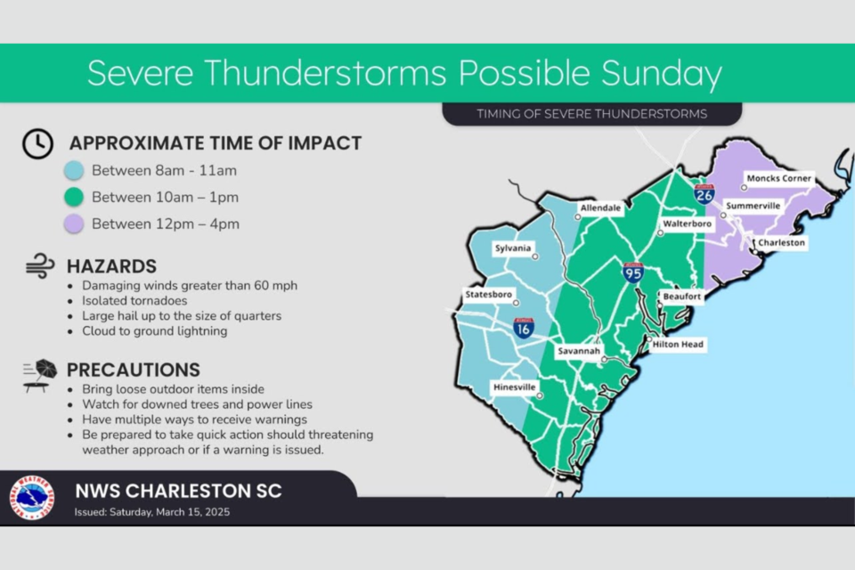
Key Hazards:
- Damaging Winds: Expect wind gusts exceeding 60 mph.
- Tornadoes: A few isolated tornadoes are possible.
- Hail: There is a low chance of quarter-sized hail.
- Heavy Rainfall: Rainfall amounts are expected to be between 0.5 and 1 inch, with some areas potentially receiving more.
- Cloud to ground lightning
While the environment for severe weather is expected to be more favorable in Mississippi and Alabama on Saturday, strong wind shear values will remain over Georgia, increasing the risk of significant severe weather if storms can maintain their strength.
Precautionary Measures:
- Secure Loose Items: Bring all loose outdoor items inside to prevent them from becoming projectiles.
- Stay Informed: Have multiple ways to receive weather alerts, especially during overnight hours.
- Power Outages: Be prepared for potential power outages due to downed trees and power lines.
- Tornado Safety Plan: Review your tornado safety plan and ensure everyone in your household knows where to seek shelter.
- Travel Safety: Be aware of potentially hazardous driving conditions.
- Stay away from downed power lines.
Important Reminders:
- Continue to monitor updates from the Storm Prediction Center, the National Weather Service, and reliable media outlets.
- This event is expected to occur overnight into Sunday morning, so ensure you have a way to receive alerts while sleeping.
Residents are advised to take these warnings seriously and take necessary precautions to ensure their safety.


