
With around 3,250 housing units and numerous commercial properties in varying phases of construction, the need for a central information source has risen to the attention of the City of Statesboro's department of Planning & Development, which has responded with the creation of the “real-time” map in collaboration with Central Services.
"The map categories were based on the phase of development for each project. Projects of a specific type (Residential or Commercial) really have the same processes, so this will allow our residents and stakeholders from the development community to get a better idea of where development pressure is throughout the City," commented Planning and Housing Administrator Justin Williams in an email.
"We have already received interest about the map from outside developers who are looking at opportunities to invest in our City. This map is just another way that people can get a true understanding of what our City is doing, and how much they can expect in the future," Williams wrote.
He also commented that the maps will aid utility service providers in their planning efforts, serving as a model of the quickly evolving landscape of Statesboro.
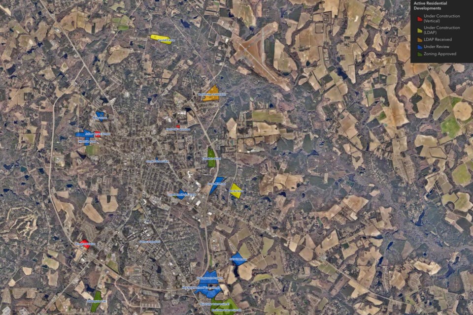
The residential map consists of developments at a minimum size of 40 units, and phases of activity include the following categories:
- Under Construction (Vertical)
- Under Construction (Land Disturbance Activity Permit) (LDAP) (Site preparation)
- LDAP Received
- Under Review
- Zoning Approved
Active commercial developments are divided into the following categories:
- Inspection Started
- Plan Approved
- Permit Issued
- Not Started
Additionally, the municipal mapping page hosts the council district and municipal zoning map for the public’s viewing.
This page will provide consistent communication to the public through weekly updates to the commercial and residential developments. You can find the municipal mapping HERE or navigate to the city website and follow the “municipal mapping” link under the Planning and Development tab.


