
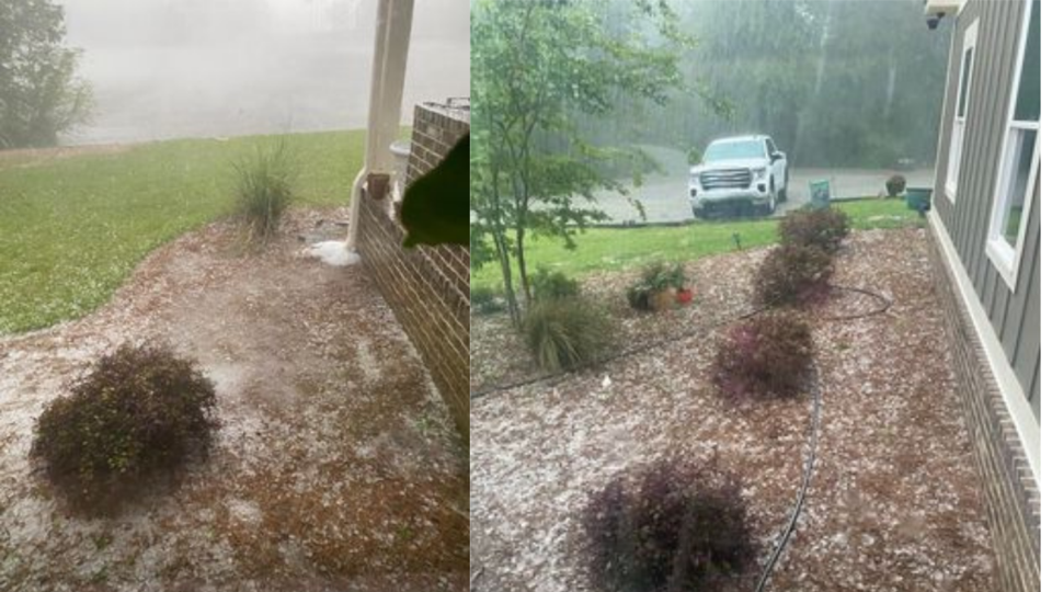
The National Weather Service issued a Severe Thunderstorm Warning Sunday afternoon, April 17, 2022 for Bulloch County. The NWS also warned citizens to prepare for hail up to the size of a quarter as the storm moved through the area.
At 7:15 pm Grice Connect followers began reporting hail in the Westside of Bulloch County in the Hopeulikit area.
Video of hail shared by a resident near Hopeulikit this evening. #savwx #gawx pic.twitter.com/ZbbaurAewi
— NWS Charleston, SC (@NWSCharlestonSC) April 18, 2022
Hail Reports to Grice Connect
- Robby Terri Bailey - Pebble sized hail on Friendship Church Rd close to Williams Road
- Melissa Gwinnett - Hail off of Williams Road
- Katie Stringer Page Teeny tiny hail at our house (Rolling Woods)
- Cindy Lewis Bowers - We had a lot at our house!
- Katie Cartee - We had a lot in Hopeulikit!!
- Teri L Hendry - Had it here!
- Sarah McCorkle - Hail came out of nowhere on Williams Road! It just got done and clearing up.
There was no significant damage reported to GC. Heavy rain and hail which only lasted a few minutes.
Thunderstorms and Heavy Rainfall Overnight
Sunday, April 17, 2022
Cloudy this evening with thunderstorms developing after midnight. Potential for heavy rainfall. Low 62F. Winds SSE at 5 to 10 mph. Chance of rain 80%.
Monday, April 18, 2022
Thunderstorms in the morning, then partly cloudy late. Storms may contain strong gusty winds. High 76F. Winds W at 10 to 15 mph. Chance of rain 90%.
Flood Warning Monday Morning Until Further Notice
Affected Area
Ogeechee River near Eden
Description
WHAT...Minor flooding is forecast.
WHERE...Ogeechee River near Eden.
WHEN...From Monday morning until further notice.
IMPACTS...At 12.0 feet, water encroaches on some homes along Dashers Landing Road and Yarbrough Landing Road. Davis Landing Road also becomes impassable.
ADDITIONAL DETAILS... - At 815 PM EDT Sunday, April 17, 2022 the stage was 10.3 feet. - Forecast...The river is expected to rise above flood stage late Monday morning and continue rising to a crest of 11.8 feet early Tuesday afternoon. - Flood stage is 11.0 feet.


