From Bulloch EMA
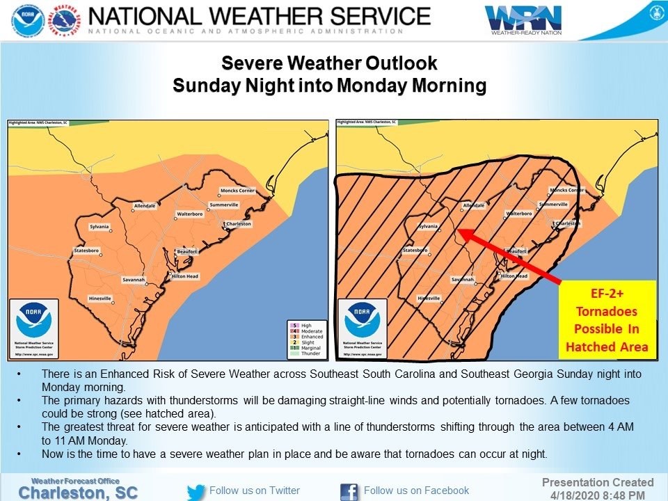
- Confidence continues to increase that a potentially significant severe weather event could occur across Southeast South Carolina and Southeast Georgia this afternoon into Monday morningas a potent storm system affects the area
•Scenario: Several rounds possible
- Round 1:Isolated severe thunderstorms across Southeast Georgia/far Southern South Carolina this afternoon (mainly 1-6 PM)
- Round 2 [greatest risk]: Scattered to numerous severe thunderstorms across Southeast South Carolina/Georgia this evening into early Monday morning (mainly 6 PM –2 AM)
- Round 3:A squall line of scattered severe storms could move west to east across Southeast South Carolina/Georgia Monday morning (mainly around daybreak)
•Hazards:
- Damaging winds in excess of 70 mph (main hazard)
- Tornadoes (EF-2 or greater possible)
- Large hail (quarter size or greater)
- Heavy rainfall (low risk for flash flooding)
•Confidence:
- High for severe hazards; moderate for timing
Our EMA Facebook Page Continue to have issues. Please Like the Bulloch VOAD page as we will post there until issue resolved.