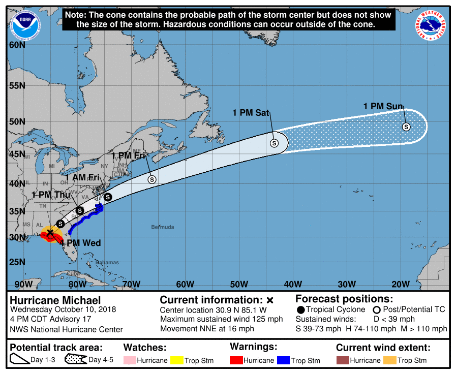
Michael 5pm update from the National Hurricane Center:
Hurricane Michael made landfall on the Florida panhandle around 2pm near Panama City Fl with winds at 155mph. Currently the center is located near the Alabama Georgia line just north of Florida. It is still a very dangerous hurricane. It is almost in Georgia.
- Movement is to the NNE at 16mph
- Current sustained winds are at 125 mph
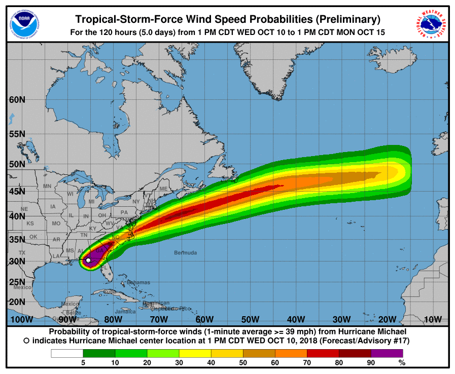
- We continue to be under a tropical storm warning and a tornado watch
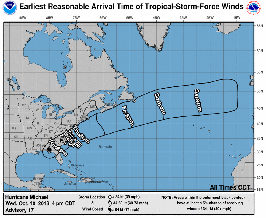
- Tropical storm force winds are expected here around 9pm and will continue until Thursday morning around 10am.
Expected conditions:
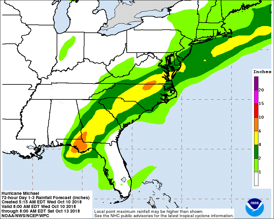
- Rainfall of 3-5 inches starting today through Thursday
- Tropical Storm force winds
- Isolated flash flooding possible starting tonight through Thursday
- Some downed trees and power lines are possible
- Power outages are expected
- Isolated tornadoes possible mainly tonight through Thursday morning.
From Ted Wynn:
We are asking citizens to stay put in a safe location until the storm passes and we have the opportunity to assess damages and potential dangers to the public. We want you to know that in the case of an absolute emergency we will respond to calls for service but, in the event, that it becomes too dangerous for Deputies and police to be on patrol we will stage them in a safe place until the storm passes. Unless the situation turns grave Sheriff Brown has no plans to initiate any type of curfew other than asking citizens to please use common sense and not be out in the storm unless it is an absolute emergency. We will update any changes or concerns as information is available.
Bulloch EMA
Ted Wynn, Director
Bulloch County Public Saftey